
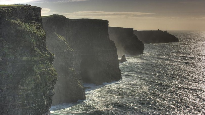
Cliffs are not simply high walls of rock. They are boundaries produced by uplift, faulting, glaciers, waves, rivers, and erosion, often acting in combination. Rankings by “height” can be misleading because sources measure from different starting points and disagree about what counts as vertical. These ten landscapes are presented for geological and cultural variety rather than as a definitive tallest-to-shortest list.
1. Cliffs of Moher, Ireland
Layers of sandstone, siltstone, and shale expose sediments formed more than 300 million years ago. Atlantic waves attack the base while weather weakens the upper rock, producing caves, stacks, and periodic collapse. The official site warns visitors to stay on marked paths and away from unstable edges.
2. Kalaupapa cliffs, Hawaiʻi
Molokaʻi’s north shore rises dramatically above the Pacific. National Park Service geologists describe a huge flank collapse, followed by erosion and later volcanic activity, as central to the landscape’s formation. Kalaupapa is also a place of living community and painful history connected to the forced isolation of people with Hansen’s disease.
3. Preikestolen, Norway
This broad rock platform stands above Lysefjord in a landscape shaped by glaciation. The famous viewpoint requires a substantial hike over uneven terrain. Norwegian guidance stresses weather checks, suitable clothing and footwear, honest assessment of ability, and willingness to turn back.
4. Bunda Cliffs, Australia
Along the Great Australian Bight, long limestone cliffs mark the edge of the Nullarbor Plain. Horizontal layers record ancient marine environments, while powerful Southern Ocean waves continue to reshape the coast. Designated lookouts provide safer views than informal approaches to the rim.
5. Cabo Girão, Madeira
This volcanic sea cliff rises steeply above Madeira’s southern coast. A developed viewpoint makes the scale accessible, but its glass platform and road access should not distract from the island’s volcanic origin and the agricultural terraces fitted into demanding terrain below.
6. Étretat, France
Chalk cliffs on the Normandy coast contain arches, headlands, and a needle-like stack. Waves and weather exploit fractures in the chalk, while harder flint bands create visible dark lines. Tides can cut off beach routes, so visitors should consult local access information before walking below the cliffs.
7. Cape Enniberg, Faroe Islands
The northern end of Viðoy presents a steep basalt face to the North Atlantic. Repeated lava flows, glacial shaping, and marine erosion contribute to the scenery. Fog, wind, wet ground, and exposed routes make local guidance essential for hikers.
8. Mount Thor, Canada
In Auyuittuq National Park on Baffin Island, Mount Thor is known for an exceptionally steep rock face. This is remote Arctic terrain, not a roadside viewpoint. Travel requires planning around weather, river crossings, wildlife, communications, and park procedures, often with experienced local operators.
9. Vermilion Cliffs, United States
Colored sedimentary layers form escarpments and intricate erosional features across northern Arizona. Some sought-after areas use permit systems to limit damage and manage safety. Heat, scarce water, flash floods, and difficult navigation can be more important than the apparent steepness of a photograph.
10. Torres del Paine, Chile
Granite towers and adjacent sedimentary rocks in Patagonia were exposed and sharpened by uplift and glacial erosion. Rapid weather changes and strong winds shape every visit. Official park rules protect fragile vegetation and require travelers to use authorized campsites and trails.
Why cliffs demand distance
- Rockfall can occur without visible warning above or below a cliff.
- Wind gusts are stronger and less predictable near exposed edges.
- Tides can trap walkers beneath coastal cliffs.
- Shortcuts damage vegetation whose roots help stabilize thin soils.
- Drones, climbing, and backcountry travel may require permits.
A cliff’s drama comes from active processes, not frozen scenery. The safest and most respectful viewpoint is usually the one established by the people who manage the landscape.
Sources: Cliffs of Moher official geology guide; National Park Service: Kalaupapa Geology; Visit Norway: Preikestolen Safety; National Natural Landmarks Program.